Community Survey Schedule
The Illinois Department of Natural Resources, Office of Water Resources (IDNR/OWR) is partnering with the Prairie Research Institute to examine flood risk throughout Rock Island County, Peoria County, and the City of Ottawa.
A professionally licensed survey crew will be in these areas between June through October. Teams of two surveyors will spend about 20 minutes on each property, measuring the elevation of the first floor and the lowest entry point for water flooding into a home. Approximately 3,200 homes will be surveyed in Rock Island County, 1,500 in Peoria County, and 120 in Ottawa. No disruption to the property is anticipated.
Thank you for your understanding and cooperation in this study effort to potentially improve your community.
Rock Island County
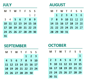
The collection of selected structure elevations in Moline is now complete. For other communities, structure elevations will be collected either from September 4 to September 15, 2017, or from July 5 to October 2017.
City of Moline

Rock Island County (excluding Moline)
Peoria County
The collection of selected structure elevations in Peoria County is now complete.

Ottawa
The collection of selected structure elevations in Ottawa is now complete.